Current mission: look through the wiki for articles that could fit in portals, then click the appropriate header, edit source, and add it to the list alphabetically. Example
File:UK 1914.svg
From Soyjak Wiki, the free ensoyclopedia
Jump to navigationJump to search

Size of this PNG preview of this SVG file: 450 × 456 pixels. Other resolutions: 237 × 240 pixels | 474 × 480 pixels | 758 × 768 pixels | 1,011 × 1,024 pixels | 2,021 × 2,048 pixels.
Original file (SVG file, nominally 450 × 456 pixels, file size: 477 KB)
Summary
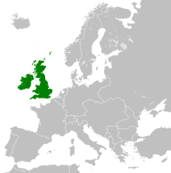
| Description |
English: Map of Europe showing the UK in 1914 |
| Date | |
| Source | Own work based on: Blank map of Europe 1914.svg |
| Author | SaturatedFatts |
| SVG development |
.svg&lang=en)
.svg)
Licensing
I, the copyright holder of this work, hereby publish it under the following license:
This file is licensed under the Creative Commons Attribution-Share Alike 3.0 Unported license.
- You are free:
- to share – to copy, distribute and transmit the work
- to remix – to adapt the work
- Under the following conditions:
- attribution – You must give appropriate credit, provide a link to the license, and indicate if changes were made. You may do so in any reasonable manner, but not in any way that suggests the licensor endorses you or your use.
- share alike – If you remix, transform, or build upon the material, you must distribute your contributions under the same or compatible license as the original.
File history
Click on a date/time to view the file as it appeared at that time.
| Date/Time | Thumbnail | Dimensions | User | Comment | |
|---|---|---|---|---|---|
| current | 17:28, 19 October 2021 | | 450 × 456 (477 KB) | wikimediacommons>SaturatedFatts | {{Information |Description={{en|1=My own work based on File:Blank map of Europe 1914.svg}} |Source={{own}} |Date=2021-10-19 |Author=SaturatedFatts |Permission= |other_versions= }} == {{int:license-header}} == {{self|cc-by-sa-3.0}} Category:Locator maps of former countries of Europe (green and grey scheme) Category:Maps of the United Kingdom of Great Britain and Ireland |
File usage
There are no pages that use this file.